XKCD: What your favorite map projection says about you
July 19, 2015
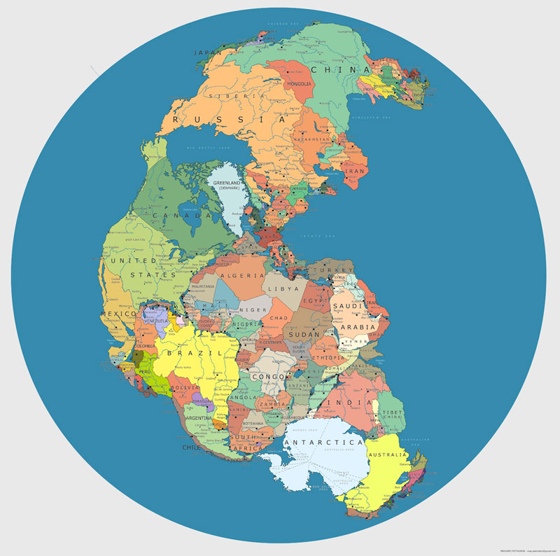
“One of the most popular projections is the Mercator, but of course, it too has its flaws. In truth, Africa is 14 times larger than Greenland, Canada is only 1.2 times the size of the United States, and Antarctica is definitely not the colossal continent it is portrayed to be.
“However, don’t get the idea that the Mercator is a bad map. It’s not. The map preserves “true compass bearings between any two points” and has become a standard in nautical navigation.
“Since there is no perfect map for all occasions, your best bet is to pinpoint what you need a map for and then to weigh the advantages and disadvantages of each to suit your goal.”
http://www.iflscience.com/environment/how-maps-can-lead-you-wrong-idea
“Ancient Polynesians settled 10 million square miles of the Pacific by navigating sailing canoes from island to island. But their tremendous story was almost lost. Can a single sailing canoe from Hawaii restore the pride of the Polynesian culture after years and years decay and denial?”
 Any time you take something as massive and complex as the earth and try to put it down on a flat piece of paper you are going to lose details and create inaccuracies. You also have to make choices about how you represent the information. For example, what goes in the center? What goes at the top of the map? The bottom? Is the most “accurate” map the best map?
http://www.viewsoftheworld.net/?p=752
A funny way to interpret your choice of projections
A very nerdy and almost too thorough explanation of the errors of map projections